*you agree to recieve our news, updates and discounts.
Short Description: Inmarsat Satellite Coverage Map ...
Home / Downloads / Inmarsat Satellite Coverage Map
Page Link: https://apollosat.com/download/inmarsat-satellite-coverage-map/
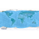
Inmarsat Satellite Coverage Map
| File | Action |
|---|---|
| InmarsatSatellite-CoverageMap_ApolloSatellite.jpg | Download |
*When you submit your name and email address, you are signing up for the Apollo Satellite News & Updates Mailing List